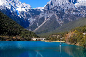
It is well-known that Mount Everest, located in the Nepalese Himalayas, is considered the premier mountain in the world. However, it may come as a surprise that Everest is not necessarily the highest mountain on Earth, as different parameters are used for measurement.
Mount Everest holds the distinction of being the most famous and captivating mountain range on Earth. It was first conquered by Tenzing Norgay, a Nepalese Sherpa, and Edmund Hillary, a New Zealander, on May 29, 1953. Since then, over 4,000 individuals have successfully climbed it, although it has also claimed the lives of more than 300 people since records began in 1922.
Researchers have conducted numerous measurements of Everest over the years, with the latest assessment, published in November 2021, placing its height at 8,848.86 meters above sea level. However, this raises the question: why is "above sea level" used to determine the world's highest peak?
When measuring heights, a consistent baseline or standard point is necessary for comparability. Historically, and still, currently, the height of a mountain is typically measured against sea level, with elevation expressed as the height above mean sea level. It is important to note that sea level varies worldwide and is subject to climate change, thus requiring a defined standard mean sea level as a reference.
As a result, elevations are measured from the mathematically defined Earth's geodetic level, which represents the global mean sea level used for precise surface height measurement. This method, combined with GPS readings, provides accurate elevation readings. Therefore, all mountains are measured from the mean sea level for convenience and consistency.
However, if measuring from the bottom to the top of a mountain, Mount Everest would not be the highest peak. The honor would go to Mauna Kea, an inactive volcano in Hawaii.
While its summit stands at only 4,205 meters above sea level, much of Mauna Kea is hidden below sea level. The U.S. Geological Survey states that from base to summit, Mauna Kea measures 10,211 meters, making it significantly higher than Mount Everest.
Determining the tallest mountain on Earth depends on perspective and agreement. If oceans did not exist on our planet, Mauna Kea would indisputably be the highest peak. Moreover, when comparing the highest mountains on other celestial bodies in the solar system without oceans, Mauna Kea remains quite remarkable.
Additionally, Mount Chimborazo in Ecuador possesses a unique distinction as having peaks farthest from the center of the Earth. Although Chimborazo is not the tallest mountain in the Andes, its location near the equator plays a significant role.
The Earth, being an oblate spheroid, bulges along the equator due to rotational forces. Situated 1 degree south of the equator, Chimborazo Peak is 4,208.73 kilometers from the Earth's core, 2,072 meters farther than Everest Peak.
While Mount Everest retains its status as the highest mountain based on elevation above sea level, Mauna Kea and Chimborazo present alternative perspectives.
Mauna Kea emerges as the tallest mountain if sea level is not considered, and Chimborazo holds the distinction of being the highest place on Earth when measuring the distance from the center of the planet. Each perspective offers a fascinating understanding of Earth's diverse and impressive geography.