The satellite positioning system enables the simultaneous observation of four satellites at any time and at any point on Earth, facilitating navigation, positioning, and timing functions.
It has permeated various aspects of our work and life, yielding significant economic and social benefits.
This article will briefly introduce some principles and applications of satellite positioning to provide a better understanding of BeiDou and satellite positioning.
1. What is GNSS?
The Global Navigation Satellite System is a unified term for systems such as BeiDou, GPS, GLONASS, and their enhanced systems (including satellite-based augmentation and ground-based augmentation). It refers to all these satellite navigation positioning systems and their enhanced systems as a combined entity.
2. Components of a GNSS Receiver
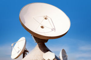
a. Antenna: Receives satellite signals. Due to the weak satellite signals, a larger antenna is preferable, but the size is constrained because the receiver needs to be mobile. The main functions of the antenna are signal amplification and suppression of multipath effects.
b. Radio Frequency (RF) Module: Downconverts, amplifies, and filters raw signals to extract useful signals for decoding.
c. Baseband Processing: Decodes satellite signals to obtain satellite messages. Each satellite signal requires a separate channel for processing. More channels lead to richer satellite observations and higher positioning accuracy. The decoding process involves searching, locking, and tracking steps.
Pseudo-codes for each satellite are generated, and then correlation with the signal occurs. Once a certain level of correlation is achieved, the satellite is locked, followed by code locking, bit synchronization, and frame synchronization, eventually extracting the message.
This process continues because of the Doppler effect, where signal frequency continuously changes. Thus, locally generated pseudo-codes also need to adapt to satellite changes in frequency. Losing the lock results in signal loss and inability to position.
d. PVT (Position, Velocity, Time) Solution: Utilizes decoded baseband messages, extracts information such as timestamps and ephemeris, and calculates positions, velocities, and times using formulas, outputting the results to applications.
3. GNSS Errors
Satellite signals experience delays when transmitted through the atmosphere. The ionosphere, thousands of kilometers thick, contains ionized electrons, slowing down electromagnetic waves and causing delays.
Delays also occur in the troposphere and near the Earth's surface due to various structures such as buildings, mountains, and bodies of water, leading to reflection or refraction of satellite signals (multipath effects).
There are system-related errors such as clock deviations and processing delays on both the transmission and reception sides. These delays, along with propagation delays, mean that the transmission time of satellite signals is not accurately equal to the physical distance divided by the speed of light.
Additionally, satellite ephemeris contains errors, resulting in discrepancies between satellite positions and actual positions, ultimately leading to positioning inaccuracies.